Ever wished you could glance at a map and see your business activities? When you have multiple sites in various locations – with employees bouncing between them – it can quickly become an admin nightmare.
That’s why our Mapping features are so valued – but more on that in a bit.
This month’s feature showcase is brought to you by Tyron, our Customer Support Lead. Here’s a little more about him…
- He has a passion for cars – racing, fixing them up, etc.
- When he’s not in the garage or helping customers, Tyron enjoys fishing.
- He enjoys time with his 1-year-old son – and teaching him the mechanical trade so long (never too early, right?)
Now let’s dive into Mapping.
“Managers and administrators are able, at a glance, to see the last location of their employees through mobile Forms filled out. This allows, among other things, to calculate travel time and plan more efficiently as data becomes available.” – Tyron
How Does It Work?
By using the Location Field to capture GPS coordinates in your Forms and/or Data Sources, you get access to various helpful screens on both the mobile app and the backend Web Portal.
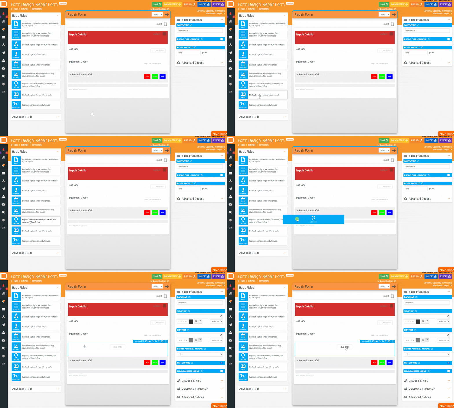
To use this feature, simply drag the “Location” Field onto your form of choice.

From there, it can be set up in various ways – we’ll lightly cover a few applications below. If you do need any further help, however, please don’t hesitate to get in touch with the Customer Success team.
Web Portal Uses (For Admin & Management)

From the Appenate Web Portal, there are a variety of uses for Location Fields.
Firstly, you can see a general overview of form entries via the home page (by default).
The Data Entries Map View allows you to see locations of specific Forms by using a filter. This way, you can see when and where these entries were completed and uploaded.
The Task Map allows you to filter by Task Status, by User or by User Group – so you can keep an eye on activities and spot any inefficiency to better plan out routes or sets of Tasks.
And lastly, the User Map allows you to see the last known location of a specific Users or User Group.
Mobile Client (For The Field Teams)
When using the mobile app, field workers can capture GPS coordinates and send them through to the backend for various purposes – including the use of the map views mentioned above.
They can also use the Map Of A Data Source Screen to view the site, asset or client locations. And if they’re unfamiliar with an area, a simple tap of a button can pop out Google Maps from within the app for navigation.
Tasks can also be location-dependent. That way, fields workers have to be on-site to complete a Task – so it can’t be done from their favourite pub. 😉
Real-World Application
For an example of what this looks like in the real world, let’s pretend you have multiple field workers serving multiple sites.
Specialists, specifically, may need to move between sites as needed. Hence entering these sites and their GPS coordinates into a data source can help your teams get around from within the app.
Once there, they can complete their Task or Data Entry and capture location data while they’re at it. This data goes back to the Web Portal, where the various activity maps can then be viewed by admin staff or managers.
There are various other uses for our GPS Location functionality. Such as using map overlays to track crop quality from different plots of land (brought to you by an Appenate solution provider).
Getting Creative
If you’d like to explore the GPS Features in more detail, please contact Customer Success and book a training session. Getting a grasp of the basics is the first step. 😉
If you’re new to Appenate and keen to explore what our mobile form builder & task management solution has to offer, feel free to browse around the website.
You can find more feature showcases here. Or you could visit our features page or even our blog. If you’re ready to give Appenate a go, sign up here for a free trial.

